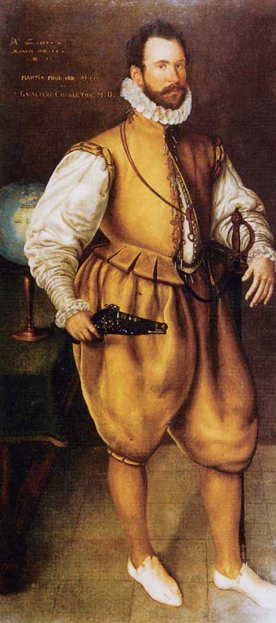
 Where and when did North America’s first gold-rush take place? Not in nineteenth-century California, but on a tiny island emerging from the sea-ice of Arctic Canada in the late sixteenth century. The island appears on modern maps as ‘Qallunaat’ – ‘White Men’ in the local Inuit language – a name that recalls events in July and August 1578 when Elizabethan explorer, pirate, business entrepreneur and naval hero Martin Frobisher had his headquarters here. It was his third and biggest expedition to the region. His mission was to find a Northwest Passage to China, stake a claim to territory by planting a colony, and load up his ships for the return voyage with gold-bearing rock. The expedition was a comprehensive failure, and Frobisher never returned. Little has happened on the island since. So when a small group of Canadian archaeologists set out to investigate in the 1990s, they found the place much as Frobisher had left it. Here, Robert McGhee, Curator of Arctic Archaeology at the Canadian Museum of Civilization, describes the archaeology of an Elizabethan adventure in the frozen wastes of the far north.
By the nineteenth century, Europe had lost all memory of the locations of Frobisher’s activities. They were rediscovered in 1861 when local Inuit people showed the sites to the American explorer Charles Francis Hall – though in fact he was searching for the lost Sir John Franklin expedition of 1845. Hall found an iron bloom, a loaf-like lump of iron and slag produced by a primitive smelting process, which he sent with other finds to the Smithsonian Institution in Washington DC. A century later the bloom was re-examined, and by 1980 it had yielded radiocarbon dates from the twelfth or thirteenth centuries. Had Frobisher reoccupied an earlier European settlement, perhaps of Norse colonists from Greenland? In 1981 Smithsonian investigators visited the site with metal-detectors and recovered three more blooms. When these also produced early dates, the decision was taken to excavate. As well as searching for a medieval settlement, the archaeologists would seek information about Elizabethan technology for mining and assaying (the testing of metals and metallic ores to determine ingredients and quality). Before permitting this work, the Canadian government decided to assess the state of the remains and the long-term threats posed by research, erosion and tourism.
The remains of past human activities are remarkably preserved by the cold and isolation of the Arctic. When our small party arrived there in 1991, we found Qallunaat Island much as it must have looked a few weeks after the English left and the Inuit had finished dismantling the standing structures to salvage wood and nails. The few hectares of rock and gravel are mostly bare of vegetation, and the exposed surface is littered with traces of the past. The mines from which the Elizabethans had taken several tons of rock survive as large open trenches. The face of one trench still bears the scars left by hand-mining tools, and a pile of broken ore awaits carriage to the ships. Scatters of ceramic, charcoal and slag surround the remains of assaying shops, and circles of boulders show where miners secured their tents. A tumble of rock and mortar at the summit of the island is all that remains of the first stone structure built by the English in the New World.
Irregular patches of bare earth demonstrated to us the vulnerability of the island’s fragile ecology. These were places that had been stripped of vegetation to provide insulation for the walls of Elizabethan buildings, so we knew that even limited excavation would leave scars on the surface of the island visible for centuries. And we soon learned that the most damaging erosion of all was caused by archaeologists’ feet traversing the steep coastal verges in search of fragments of ceramic, charcoal and slag.
In our main excavation we wanted to find out how much remained of a large cache of material we knew was buried when the island was abandoned in 1578. ‘We buried the timber of our pretended fort,’ records a contemporary account, ‘with many barrels of meal, peas, grist and sundry other good things,’ and these were ‘hidden and covered in the place of the mine.’ A team led by James Tuck of Memorial University put a trench across the mine known since Charles Francis Hall’s 1861 visit as the ‘Ship’s Trench’. The excavation was located just above the level of high storm-tides, where the mine was deepest, where frozen and preserved material was likely to be found, and the heavy boulders covering the surface would easily disguise the scars left by digging. After removing the boulders, we found a jumble of earth and broken rock, small fragments of orange ceramic tile, charcoal, preserved wood, and one small unidentifiable piece of rusted iron. Most of the wood was probably from barrels. There were several lengths of split willow or osier that might have been barrel hoops. Numerous small round black objects were easily recognisable as dried peas, while lumps of black organic material were later identified as carbonised ship’s biscuit. The deposits were at least 1.5m deep. This was undoubtedly the place where the English had buried the supplies for their planned colony. They had probably covered the cache with a thick layer of boulders, but the watching Inuit must have arrived within a few days or weeks of Frobisher’s departure to recover such valuables as hardwood and iron nails. The deposit seems to have been thoroughly quarried, and only the discarded remnants had been left for us to find.
Were there any other buried caches or underground workings? We enlisted the aid of Jean Pilon of the Geological Survey of Canada, whose ground-penetrating radar provided a way of searching for Frobisher remains without leaving scars. The first set of traverses covered an area where two small oblong boulders emerged from a field of gravel, suggesting makeshift headstones, and the radar signalled that there was something buried about 1m deep to one side of the larger stone. The machine could not distinguish between a human body and a large isolated boulder, but, since the signal came from an area of apparently uniform gravelly soil, a human burial seemed likely. Radar transects across the remains of the blacksmiths’ and assaying workshops in the industrial area, on the other hand, showed no evidence for stone floors, furnaces or other buried features.
We next looked at the small structure the English had built at the summit of the island. The boulders that once formed the walls had been toppled and scattered, and the interior had been thoroughly dug out by earlier visitors. James Tuck carefully selected a few areas where minimal excavation would detect if anything was left of the original structure, and we soon found that much of the foundation was there despite the disturbance. The house comprised a single room measuring eight by ten English feet, and the walls were two feet thick and built of boulders roughly hammered into shape and cemented with lime mortar. By counting and measuring some 400 boulders that had fallen from the walls, we established that these had stood only about 1m high: the upper portions must have been of wood, and this would have been salvaged long ago. Having learned that the foundations were surprisingly well preserved, we reburied the exposed walls against the time when full and careful excavation may be possible.
What of the supposedly Norse iron blooms that had given rise to the Smithsonian’s project in the first place? Further radiocarbon analysis on the blooms yielded a range of dates between the seventh and fifteenth centuries, and there is now a growing consensus that these objects must be the ‘yron stones of Russia’, 500 of which were recorded as ballast in the accounts of Frobisher’s 1577 expedition. So there was no medieval settlement on Qallunaat Island. Instead, archaeologists had found impressive evidence for a ‘lost’ Elizabethan voyage of discovery preserved in the ice and isolation of Arctic Canada. But for how long? Safe for 400 years, the rediscovered relics of North America’s first gold-rush have triggered a heated debate: should they be excavated or conserved?
The English history of Qallunaat Island began in 1576 when Martin Frobisher set off into the northwest Atlantic to find a passage to the Orient across the top of North America. The inlet that he came to regard as a ‘strait’ leading to Asia was in fact a deep, narrow bay on the east coast of Baffin Island, but the early onset of autumn prevented him from reaching its western limit and discovering his mistake. A native was kidnapped to prove that the explorers had discovered a new country, and samples of rock and plants gathered ‘in token of Christian possession’ of the land.
Back home, a black stone picked up on a beach was submitted to various assayers and alchemists, one of whom pronounced it to be high-grade gold ore. The following year, therefore, Frobisher led three ships back to the area – now named Meta Incognita by Elizabeth I – in order to mine for gold-bearing ore. His men discovered an abundance of black rock on a small island that they named after the Countess of Warwick, and they mined and took back 150 tons of it. Further assays that winter appeared to confirm that the rock yielded gold, and a consortium of entrepreneurs and investors – some of them decidedly shady – combined to fund an expedition of fifteen ships and over 400 men the following summer.
The 1578 expedition established headquarters on the Countess of Warwick’s (later Qallunaat) Island in late July, and immediately began mining black rock. Some miners lived in tents ashore. Small workshops were built for assaying ore. Preparations were made for the establishment of an English colony which could stockpile ore and trade with the local Inuit. Eighteen months’ supplies for 100 men were unloaded, and peas and grain were planted among the rocks ‘to prove the fruitfulnesse of the soyle against the next yeare’. Fortunately for the party of prospective colonists – who would have been dead within months if left – the scheme was abandoned when it was discovered that half their prefabricated barracks had been lost in a ship sunk by ice.
In late August, with the weather deteriorating and the ships loaded with over 1200 tons of ore, Frobisher decided to leave for home. Before setting off, the supplies for the colonists were buried, and a small stone house was built to find out ‘whether the snowe coulde overwhelme it, the frosts breake uppe, or the people dismember the same’. The plan was to return the following year. But it never happened. The ore was found to be worthless and Frobisher’s finances collapsed. The Inuit, on the other hand, began a second phase of mining, recovering the lumber, oak barrel-staves and metal objects buried by the qallunaat – after whom they renamed the island.
Frobisher did not discover a Northwest Passage to the Orient. His purported gold-mine turned out to be worthless. And his attempt to plant a colony proved abortive. Yet his discoveries were the first in a series of steps that led eventually to British colonial dominance in North America. Nor was the historical role of the man himself quite played out: after a decade in the doldrums, he was to achieve renewed fame as a vice admiral of the fleet and commander of the English navy’s largest ship in the defeat of the Spanish Armada.
Should a unique heritage site be sacrificed to scientific curiosity? What makes the archaeology of Qallunaat Island special is its association with known historical figures and well-documented events. Excavation here is more truly than elsewhere ‘an unrepeatable experiment’. Is it possible to balance the competing claims of heritage preservation and archaeological research? And, as the site becomes better known and more accessible, can the remains on the island, until now protected only by their isolation, survive the impact of modern tourism?
The Canadian government has designated Qallunaat a ‘National Historic Site’, and the Meta Incognita Project was set up to mediate competing claims. The initial aim was to foster scholarship but limit archaeological intervention until a long-term plan for managing the heritage had been established. The work of Robert McGhee and colleagues was partly designed to make the detailed assessments needed. The outcome, as Robert explains, was reassuring:
‘By the end of the project, the question of research versus conservation was unresolved but less urgent. We had located the supplies cached for the eventual establishment of a colony and found them long since salvaged by the Inuit, leaving little of interest. Without damaging the landscape, we had learned that there were no features buried beneath the ruined buildings we could see on the surface. The foundations of the house at the top of the island merited a small and careful excavation, but this would be unlikely to reveal more than the general outline. With no evidence of extensive or well preserved archaeology, and none relating to European occupation before Frobisher, immediate research interest in Qallunaat Island has dissipated. Réginald Auger of Université Laval has, however, while maintaining a careful regard for the heritage values of the site, recovered additional material from the Ship’s Trench mine and other locales.’
Neil Faulkner
This article is an extract from the full article published in World Archaeology Issue 2. Click here to subscribe


